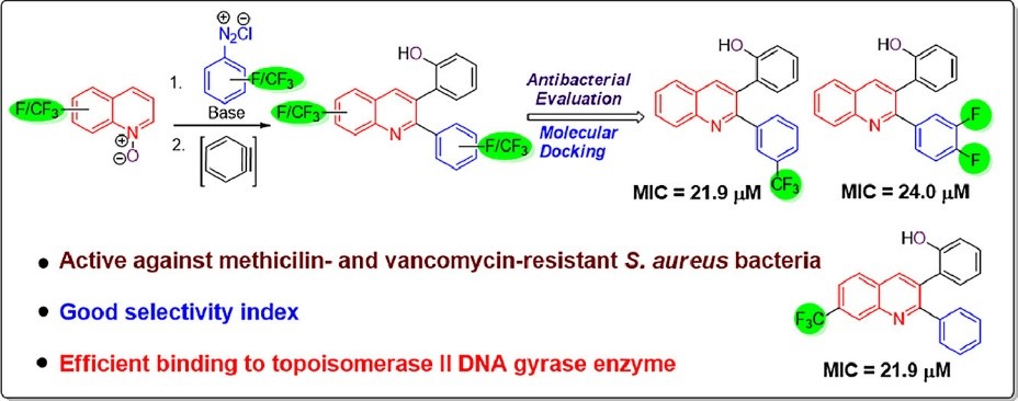
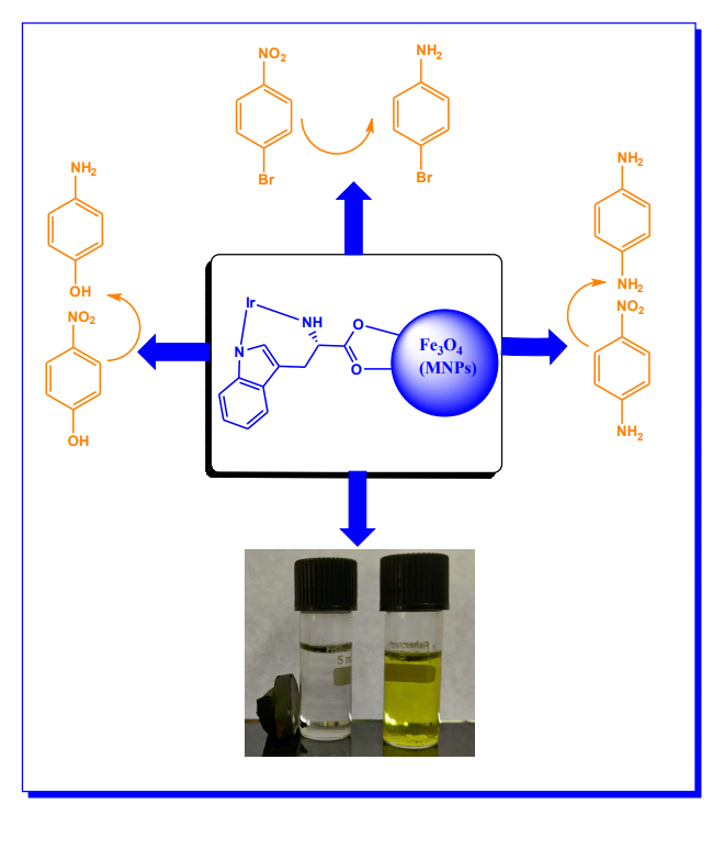
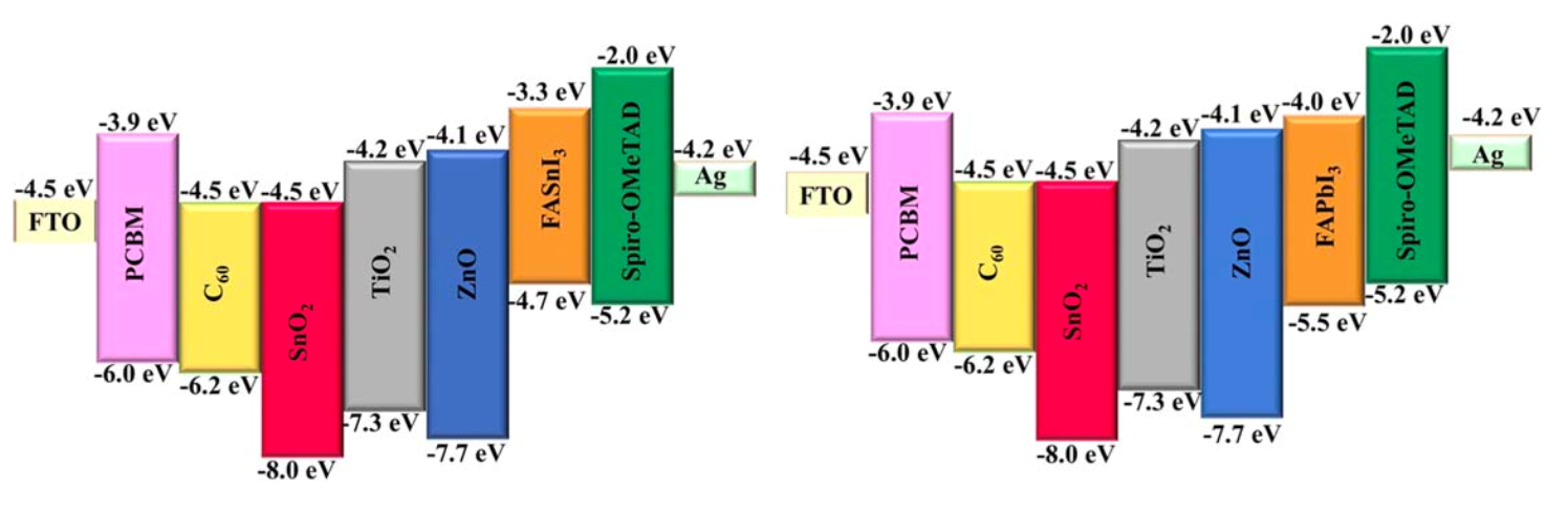
Fluorine-containing 2,3-diaryl quinolines as potent inhibitors of methicillin and vancomycin-resistant Staphylococcus aureus: Synthesis, antibacterial activity and molecular docking studies
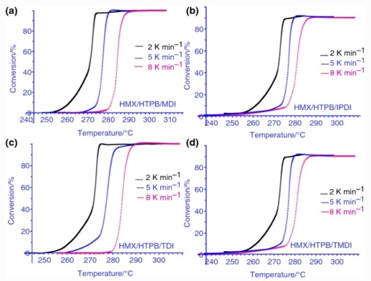
Investigations of effect of hydroxyl-terminated polybutadiene-based polyurethane binders containing various curatives on thermal decomposition behaviour and kinetics of energetic composites
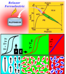
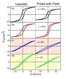
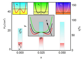
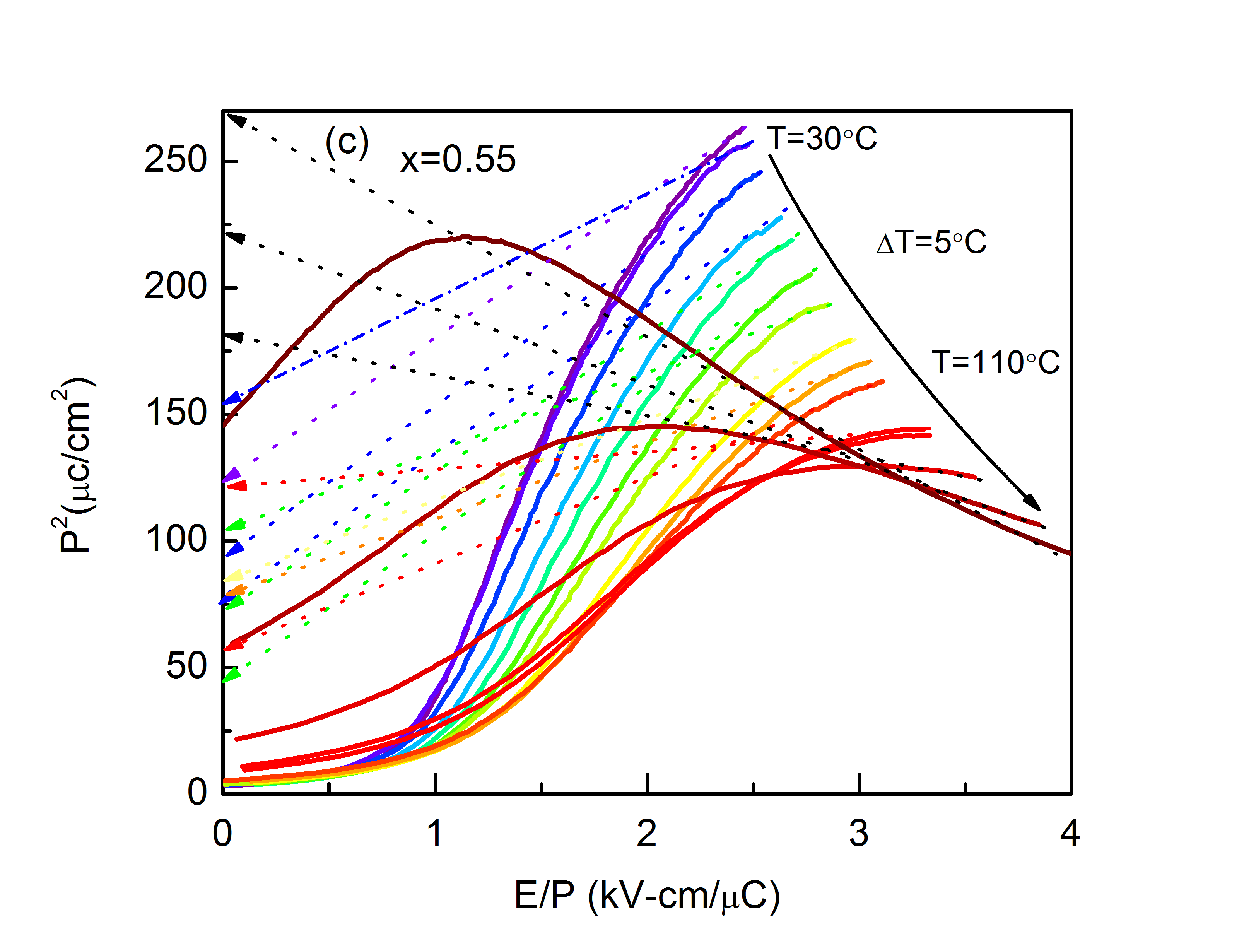
Critical Behavior of Relaxor〖 Pb〗_0.91 La_0.09 (Zr_0.65 Ti_0.35 ) O_3: Interplay between Polar Nano Regions, Electrocaloric and Energy Storage Response
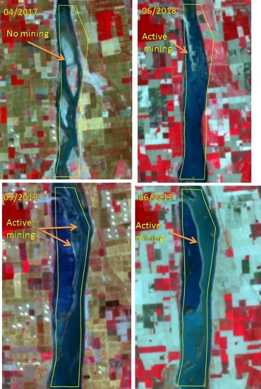
Time-dependent mechanistic insight into photo-degradation of mixed hydrophobic disperse dyes by magnetically separable nitrogen iron codoped titania under visible light using process variable optimization
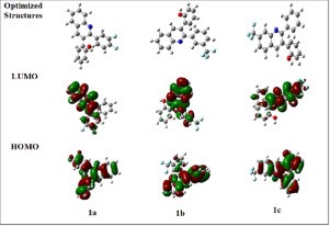
Computational investigation of bioactive 2,3-diaryl quinolines using DFT method: FT- IR, NMR spectra, NBO, NLO, HOMO-LUMO transitions, and quantum-chemical properties


 Centenary Celebrations
 Admissions
 Academics
 Student Life