


IoT Based Accident Prevention, Detection and Alert System using GPS & Heat Mapping of Accident Prone Areas of Chandigarh

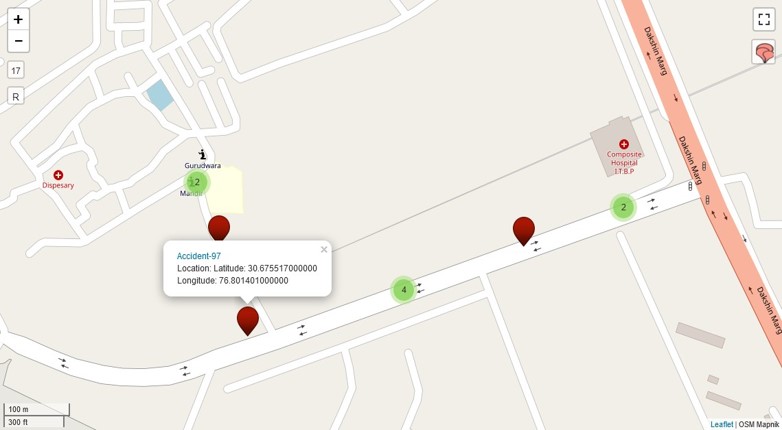
| Abstract | A Road accident is a result multiple factors or events that need to be analysed carefully. As per the official website of Chandigarh Police, under Crime and Traffic Accidents Statistics from 01.01.2019 to 31.10.2019, 249 traffic accidents have been reported. It is very important to analyze these accidents and identify hot spots. As the roadway improvements are meant to be applied to perilous locations or accident hot spots where they have the most vital impact, identification of hot spots is a vital step in safety management. This application can be used to facilitate displaying global positioning system (GPS) coordinates of road accident sites of the city online. These coordinates would be used to accurately identify the exact accident-prone areas in the city and could be accessed while sitting in any part of the country. Besides, these coordinates and software would collectively help the police to find out the nature of accidents, type of vehicles involved, vulnerable time-slot and the age group of the accused and victims. The application would help the traffic police to create GPS coordinates of the accident sites and these could be easily seen through google maps and other online mediums. This application would help the Accident Analysis Cell and Research Branch of Traffic Police, Chandigarh. |
| Faculty |
Dr. Sanjay Batish
|
|
sbatish@pec.edu.in
|
|
| Collaborations | Sh. Sushil Kumar, Sh. Prabhsimran Singh Bindra |