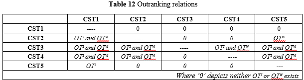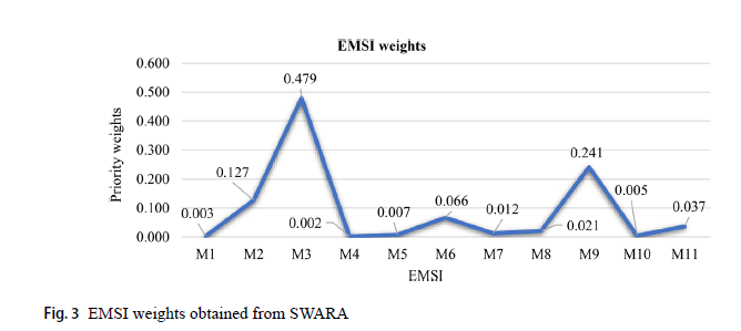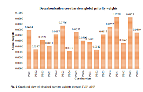
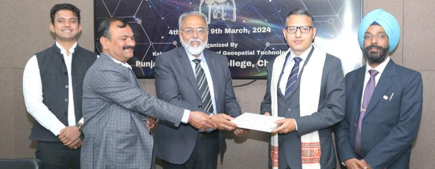
In a transformative week-long workshop, Punjab Engineering College (PEC) served as a crucible for innovation and exploration in the field of drone technology. One workshop titled Advanced Mapping through Drone Applications (AMDA - 2024) organized under the banner of the Kalpana Chawla Chair of Geospatial Technology at PEC Chandigarh. The workshop brought together a diverse array of experts, scholars, and enthusiasts to delve into the intricacies of drone technology and its applications across various domains. The words of Prof. Baldev Setia (Director PEC) that Drone Technology will be the important parameter for the Viksit Bharat during the closing ceremony is so relevant in this era. His vision for promoting the latest technology and innovation served as a guiding light for organizing this event.
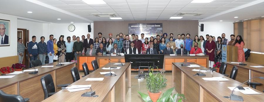
This workshop got participation from IIT Tirupati, Central University of HP, HP University, Punjab University, Chandigarh University, Thapar University, IISER, BBMB, Road Safety wing apart from research scholars and faculty from PEC.
The inaugural session, graced by Sh. Maneesh Kumar, Jt. DG (DGCA) set the stage for a week of insightful discussions. His wealth of experience in aviation safety provided invaluable insights into the regulatory landscape governing drone operations. Shri Thulasiraman Krishnan (Director DGCA), further elucidated the drone guidelines, drawing from his extensive involvement in Unmanned Aircraft Systems activities. Complementing the regulatory discourse was Sh. Ajay Godara (Founder, Enovate Skills) who conducted hands-on drone assembly training. His passion for technology and commitment to shaping the future resonated with the participants, fostering an environment of collaboration and learning. As the workshop progressed, participants were treated to a diverse array of sessions highlighting the myriad applications of drone technology. Sh. Puyam S Singh (Scientist, NE Space Application Centre) shared his expertise in UAV data processing software usage and 3D model creation. The following days featured insightful sessions on applications in Agriculture, Railways etc. by Sh. Rahul Jain (MD, Matrix Geo Solutions), helped participants to go through the flight planning processes. Further, Dr. Manmeet Singh (Scientist, Indian Institute of Tropical Meteorology) provided knowledge of deep learning- based high-impact short-range numerical weather predictions and engaged participants.
A site visit was also arranged for the participants by the Survey of India office in Chandigarh. Sh. Sandeep Kaushal (Engineer, SOI) gave an overview of the various projects viz. Large Scale Mapping and SVAMITVA Scheme, CORS Network, Drone Mapping/Operations, Data Processing of Drone Images(ORI), Feature Extraction of ORI. Apart from above, participants had also visited GTS standard Benchmark which is situated in the Survey of India Complex. Er. Gaurav Kumar Singh (Superintending Surveyor, SOI) elucidated the various uses of drone technology adopted by SOI, providing valuable insights into its practical applications. He also shared that India has shown its presence in Antarctica recently and successfully completed the first drone mission in Antarctica.
Further, Dr. S.K. Sharma (Scientist, IIRS), Dr. D.P. Shukla (Faculty, IIT Mandi), Dr Reet Tiwari (Faculty, IIT Ropar) covered a wide range of topics, including UAV data processing, disaster management, Landslide, Glacier applications, providing participants with a comprehensive understanding of the latest developments in the field. The final day of the workshop culminated in dynamic discussions, thought-provoking questions, and constructive exchanges that not only broadened participant's knowledge but also fostered a sense of community and collaboration.
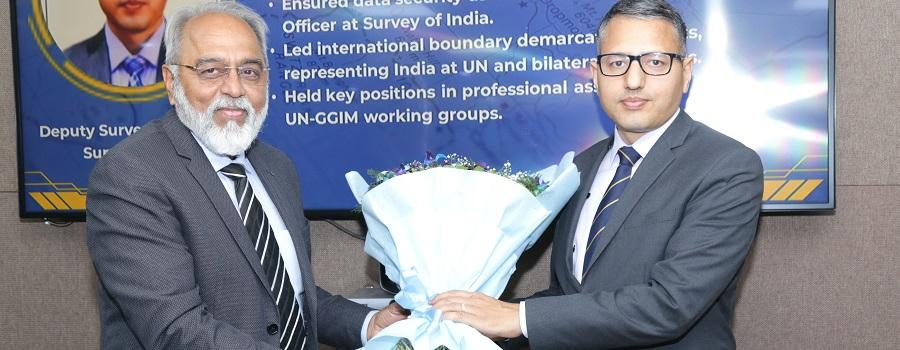
The valedictory function in the Senate hall and Sh. Pradeep Singh (Dy. Surveyor General, SOI) graced the occasion as Chief Guest and shared that the large number of villages and states has already been mapped using Drones SOI. He also gave valuable insights into future opportunities in Survey of India, inspiring participants to continue their pursuit of innovation and discovery. Prof. S.K. Singh (Faculty, PEC) thanked the participants and experts for visiting PEC and motivated them to use advanced technology not only for the mapping projects only, but for the various applications also. Prof. Baldev Setia (Director PEC) in his closing remarks motivated participants to work in the drone technology field. He also congratulated the team led by Prof. S.K. Singh, Dr. Har Amrit Singh Sandhu (Coordinator) along with students (Ankur Sharma, Vanshika Bhardwaj, Shubham Bhadoriya, Saijal Verma, Prakul Lath, and Akhilesh) of the Civil Engineering Department to facilitate the seamless execution of the workshop.