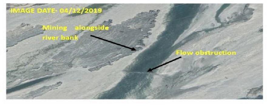
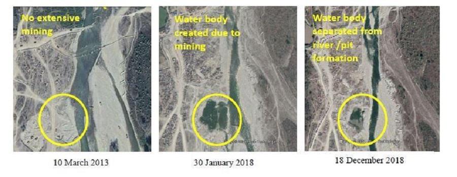
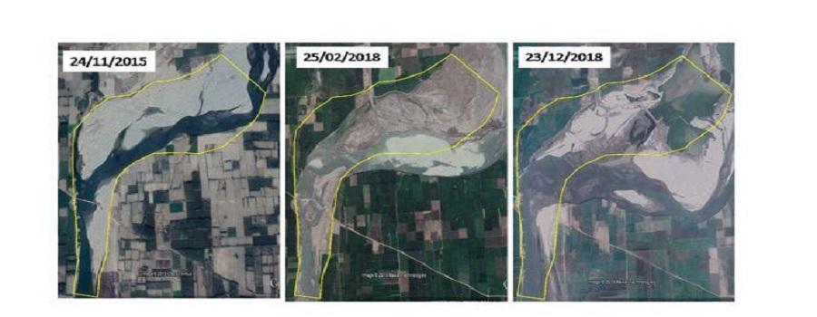
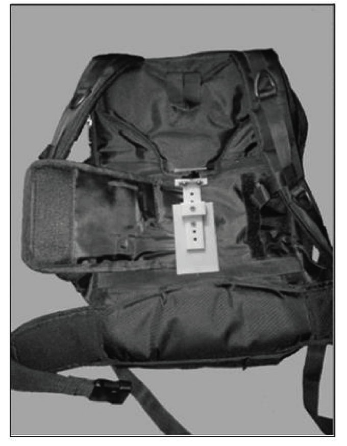
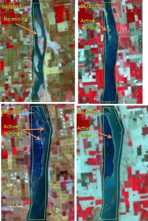
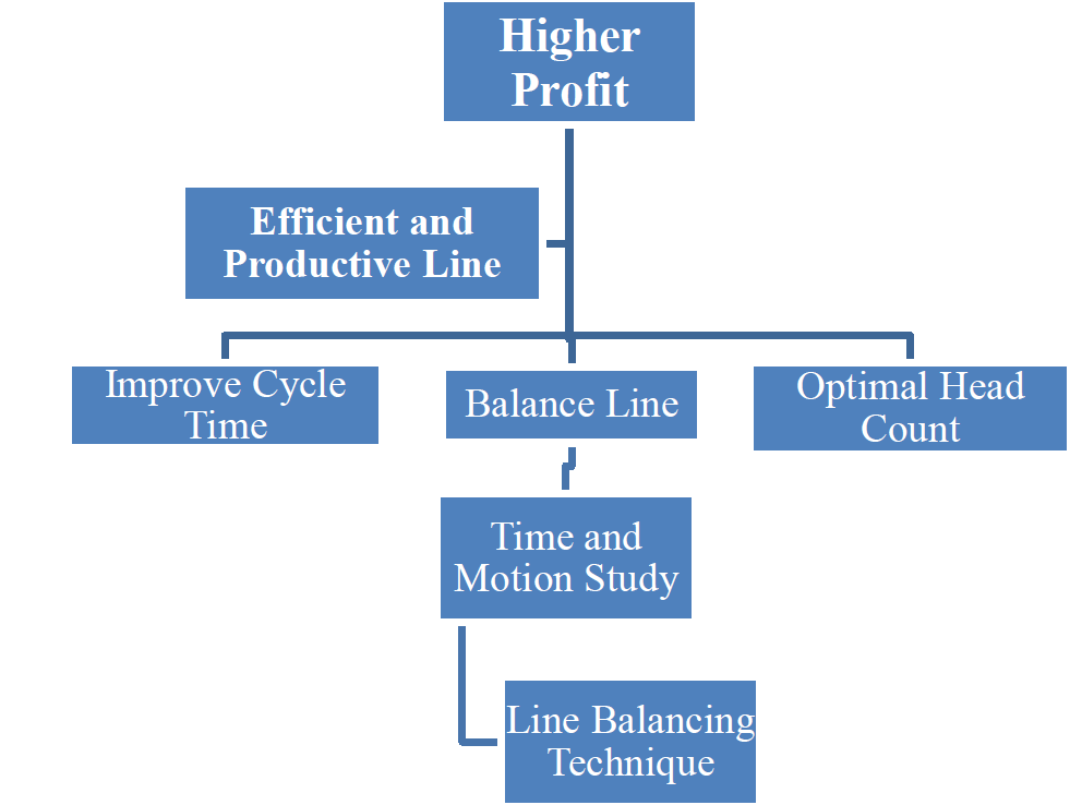
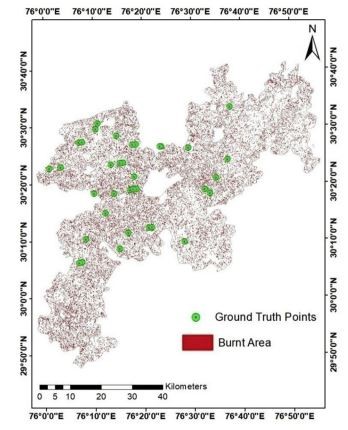
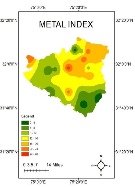
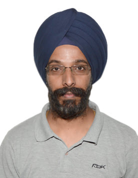
 Dr. Har Amrit Singh Sandhu, Assistant Professor of the Civil Engineering Dept. and Coordinator of Kalpana Chawla Chair of Geospatial Technology, Punjab Engineering College, Chandigarh conducted surveys to assess the feasibility of geospatial technology in resolving sand mining issues in Haryana, Uttarakhand & Himachal Pradesh. He worked in association with Principal Accountant General of Audit. Dr. Har Amrit Singh Sandhu and PhD student Rajan Dabral, Civil Engineering Department, Punjab engineering College, Chandigarh collected remote sensing images of different periods and analyzed them. Further, to confirm the results, ground visits were also done to verify remote sensing results. The results of this study were promising, and validated the use of geospatial technologies to study mining issues. The team revealed several major findings during the project like shifts of river banks due to mining and formation of pits/water bodies at mining sites using geospatial technologies. Other observations like flow obstructions due to mining along the bank and mining activities after the closure of the lease were also observed from some sites. The findings of one of the project reports have been included in the report issued by the Comptroller and Auditor General of India. The Director of the Institute Dr. Baldev Setia lauded them for their work.


PEC Prof. validates use of Geospatial Technology in Sand Mining Audit