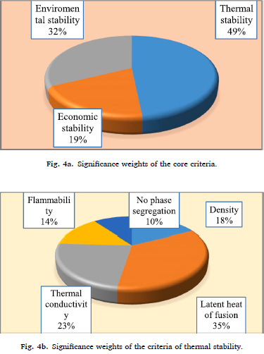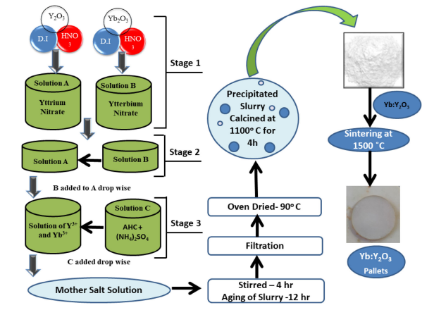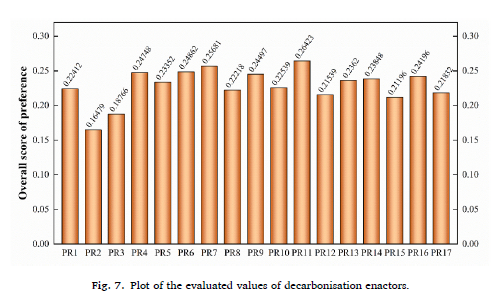
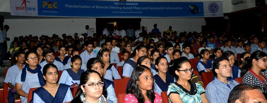
 To celebrate National Remote Sensing Day, a National Workshop on "Popularization of Remote Sensing Based Maps and Geospatial Information" was organized at PEC University of Technology on 11th August, 2017. Being a joint initiative by ISRO and ISRS, the workshop was an enlightening affair.
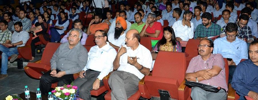
More than 300 participants from various colleges and schools attended the workshop. Director SASE(DRDO) and eminent scientists from DRDO and other institutions also graced the occasion with their presence.
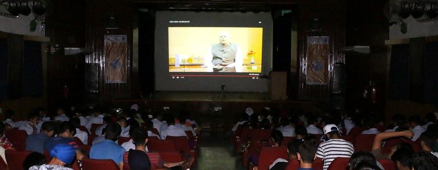
The audience witnessed the congregation of some brilliant minds of the nation in an exceedingly revealing series of lectures and discussion through live streaming in the University Auditorium.
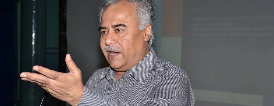
The afternoon commenced with Dr. Manoj K. Arora, Director, PEC University of Technology, giving a brief introduction on Geospatial Information Systems, their advantages and uses, especially in the Indian context. He also talked about PEC's role in the development of such geospatial awareness systems through the university's collaboration with various industries and government departments.
Through webcast, a welcome address was given by Dr. A. Senthil Kumar (Director, IIRS), who gave an overview of the research being conducted in our country into Remote Sensing as well as the scientists and engineers who are involved in the development of this field as pioneers.
Opening remarks were given by Dr. Shailesh Nayak (President, ISRS) who talked about the history of the society and the significance of remote sensing technology in the lives of ordinary Indians such as farmers and fishermen, who rely on these technologies to obtain their daily livelihood.
Dr. Kiran Kumar (Secretary, DOS and Chairman, ISRO) was the next speaker. His speech dealt with the history of remote sensing technology in our country, including the first RS satellites- Bhaskara 1 and 2. He also elucidated the importance of such Geospatial Awareness systems in helping solve the problems our nation is facing.
Dr. Tapan Misra (Director, SAC) gave a detailed speech overlaid with interesting charts and images, to help the student visualize the progress our country has made in this field. He listed the various achievements we've made to this end and talked about the different satellites we've launched.
Director of National Remote Sensing Centre, Dr. Y.V.N. Krishna Murthy highlighted the societal applications of space and technology. The students also got to know about ISRO's sensors that are being used for the observation of Earth along with the capacity building and outreach program.
The latter half of the session included speakers like Dr. S.K. Srivastav (Group Director, IIRS), Dr. Uday Raj (Chief General Manager, RRSC/NRSC) and Shri P.L.N. Raju (Director, NESAC). The plethora of speakers shared their experiences in the respective fields. The topics covered ranged from Use of Geospatial technology in North-Eastern region, Capacity Building and Outreach programme to Space Inputs for Decentralized planning (SIS-DP) initiatives.
Dr. P.G. Diwakar (Scientific Secretary, ISRO) spoke about India's Bhuvan Geoportal. The exciting technology was received well by the scientific community. Besides explaining its working and applications, he emphasized the scope of further development and research in this technology for even higher functionality.
For the planetary buffs present in the audience, demonstrations of web tools like Bhuvan, Bhuvan Panchayat and VEDAS portals were given by Shri Arul Raj (Manager, Bhuvan Cell, NRSC) and Shri Shashikant Sharma (Group Head, SAC). Developed by Space Applications Centre (SAC), these tools give 3D tours of various planets and moons, helping the curious students get a glimpse of the universe through the screen. Finally, a demonstration of the Indian Bioresource Information Network Portal was given by Dr. Sameer Saran (Head, Geoinformatics Department, IIRS and Secretary, ISRS).
This was followed by a live panel discussion with ISRS coordinators that helped everyone in attendance to clear any doubts, concerns and suggestions on their behalf. The workshop gave a surge in the knowledge about the advancing technological prospects in the field of Remote Sensing and Geospatial Information. All in all, the event was a resounding success.
The eventful and informative session ended with a vote of thanks by Dr. Sameen Saran, Secretary, ISRS. The audience was extremely delighted with the scope of the workshop and commended the Institute's ceaseless efforts to push the envelope and make technological education accessible to all.